Door of No Return Ouidah · 8 min
The Slave Route and the Door of No Return, at Ouidah
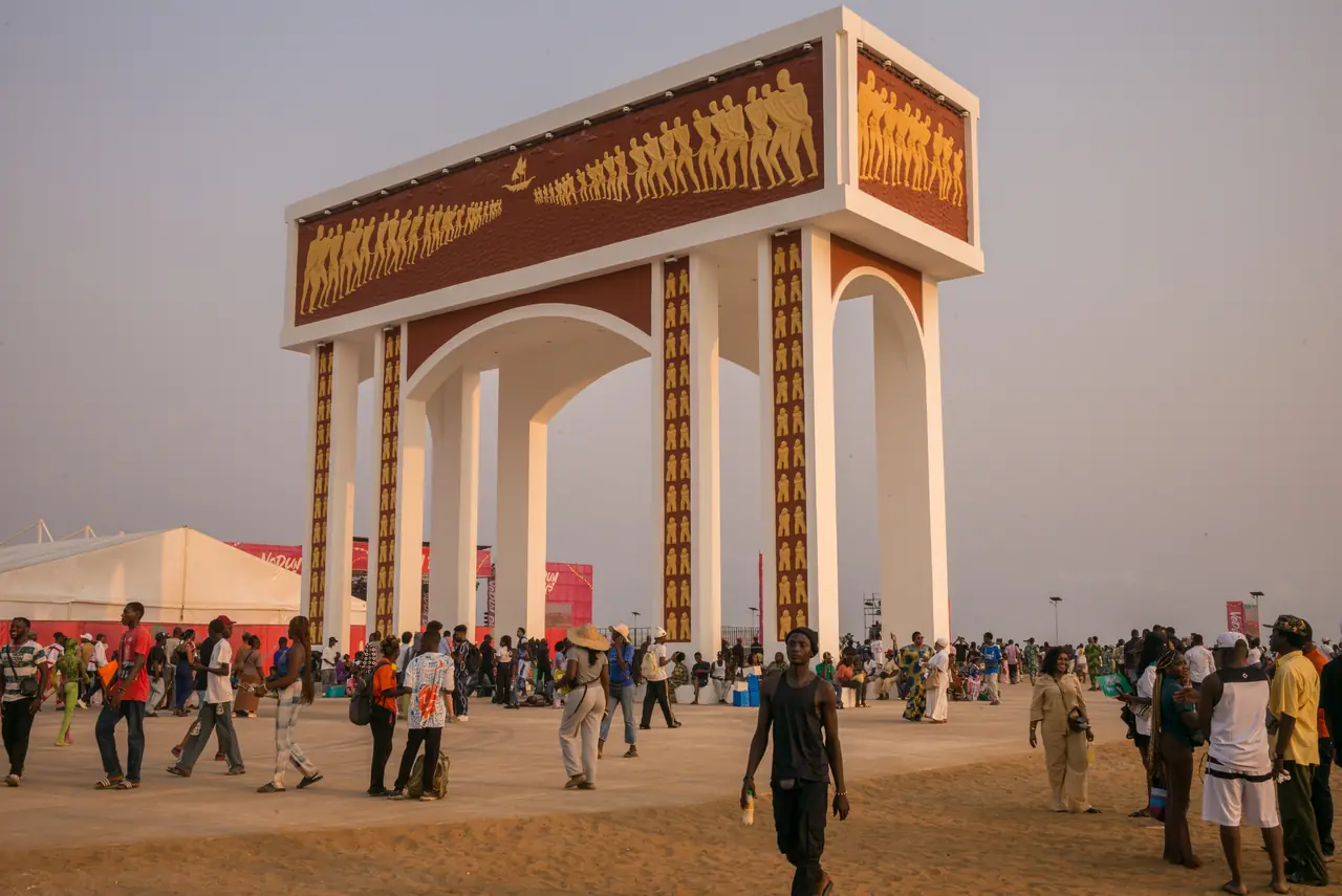
At Ouidah, a road a few kilometres long links the old auction square to the beach. It is the path taken by captives sold towards the Americas. At its end stands the Door of No Return, a memorial raised in 1995 facing the ocean.
For nearly two centuries Ouidah was one of the main ports of the Atlantic slave trade. Hundreds of thousands of people left from here. The town has not erased that history: it has made it physical, as a route you can walk or drive from the town to the sea, following the captives’ actual path.
This is not a visit like any other, and it is better to know that on arrival. The route is not spectacular. It is sober, marked by statues and memorials, and the substance is in what you are told at each stop.
What are the stages of the Slave Route?
The route starts in town, on the old square where the auctions were held, and runs down to the beach. Several stations mark it out. Two of them carry most of the weight of the place.
- The Tree of Forgetting: captives were made to circle it a prescribed number of times so that — it was said — they would forget their name, their family and their land
- The Zomaï hut, where captives were confined in darkness for weeks, to prepare them for the holds of the ships
- The mass grave, where those who did not survive that wait were buried
- The Tree of Return: captives circled it so that their spirit, at least, might come back
- The Door of No Return, on the sand, at the point of embarkation
What does the monument itself depict?
The Door of No Return is a concrete arch raised in 1995, as part of the UNESCO-backed “Slave Route” project. It carries bas-reliefs and is topped by a double file of figures turned towards the sea, representing the column of captives walking to the ships. You walk through it, and on the other side there is only the beach and the Atlantic.
How long to allow, and with whom?
Allow half a day for the full route, taking the time to stop. The last section is very walkable, which changes the nature of the visit: the distance stops being an abstraction.
Being accompanied changes everything, here more than anywhere. The stations are barely signposted, and the route can shrink to a succession of statues if nobody tells you what happened at each. This is a subject where we insist the voice explaining it be a local one.
What else is there to see at Ouidah?
Ouidah is also a major vodun town, and the two histories cross constantly. The Temple of Pythons, the sacred forest of Kpassè, and the former Portuguese fort turned history museum can be seen on the same day as the Slave Route. Every 10 January, the town hosts Vodun Days, a national public holiday in Benin.
Frequently asked questions
On the beach at Ouidah, Benin, at the end of the Slave Route running down from the town centre. Ouidah is on the coast west of Cotonou, easily reached in a day from the economic capital.
It can be, and that is normal. The route is not physically demanding, but what is recounted along it is. We never schedule it just before a festive evening, and we leave time afterwards, because many travellers need it.
Yes, in whole or in part. Many travellers walk the last section down to the beach. That is what we suggest: covering the distance physically changes how you understand it.
Next step
Ready to actually go?
Tony builds the itinerary around whatever made you want to go. Just tell him what stayed with you from this article.
Answer within 24h · No commitment